False Precision in Science: MIT Exposes the Spatial Statistics Flaw
Here is a troubling scenario that plays out more often than scientists would like to admit: a research team publishes findings claiming 95 per cent confidence that air pollution exposure reduces birth weights in a particular region. Policymakers cite the study. Regulations follow. Years later, follow-up research reveals the original confidence interval was fundamentally flawed, not because the researchers made an error, but because the statistical methods they relied upon were never designed for the kind of data they were analysing.
This is not a hypothetical situation. It is a systemic problem affecting environmental science, epidemiology, economics, and climate research. When data points are spread across geographic space rather than collected independently, the mathematical assumptions underlying conventional confidence intervals break down in ways that can render those intervals meaningless. The gap between what statistics promise and what they actually deliver has remained largely invisible to policymakers and the public, hidden behind technical language and the presumed authority of numerical precision.
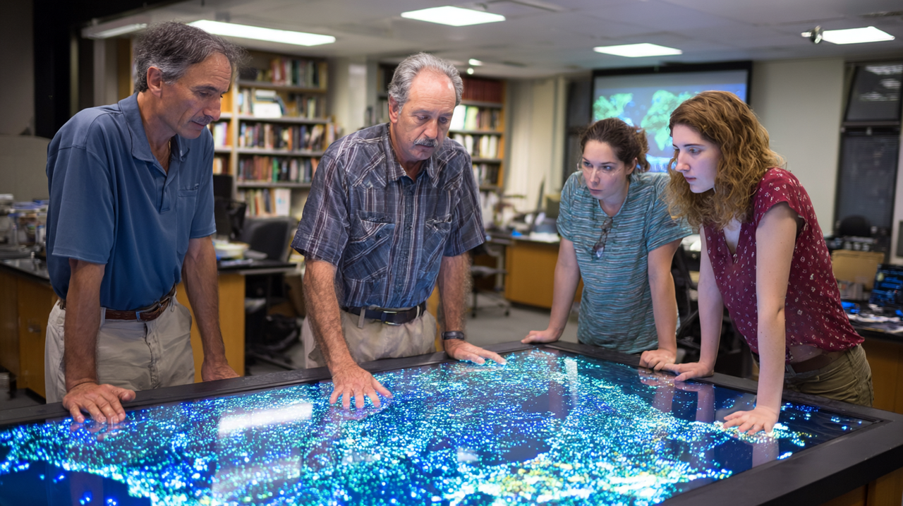
A team of researchers at the Massachusetts Institute of Technology has now developed a statistical method that directly confronts this problem. Their approach, published at the Conference on Neural Information Processing Systems in 2025 under the title “Smooth Sailing: Lipschitz-Driven Uncertainty Quantification for Spatial Association,” offers a fundamentally different way of thinking about uncertainty when analysing spatially dependent data. The implications extend far beyond academic statistics journals; they touch on everything from how we regulate industrial pollution to how we predict climate change impacts to how we rebuild public trust in scientific findings.
The Independence Illusion
The foundation of modern statistical inference rests on assumptions about independence. When you flip a coin one hundred times, each flip does not influence the next. When you survey a thousand randomly selected individuals about their voting preferences, one person's response (in theory) does not affect another's. These assumptions allow statisticians to calculate confidence intervals that accurately reflect the uncertainty in their estimates.
The mathematical elegance of these methods has driven their adoption across virtually every scientific discipline. Researchers can plug their data into standard software packages and receive confidence intervals that appear to quantify exactly how certain they should be about their findings. The 95 per cent confidence interval has become a ubiquitous fixture of scientific communication, appearing in everything from pharmaceutical trials to climate projections to economic forecasts.
But what happens when your data points are measurements of air quality taken from sensors scattered across a metropolitan area? Or unemployment rates in neighbouring counties? Or temperature readings from weather stations positioned along a coastline? In these cases, the assumption of independence collapses. Air pollution in one city block is correlated with pollution in adjacent blocks. Economic conditions in Leeds affect conditions in Bradford. Weather patterns in Brighton influence readings in Worthing.
Waldo Tobler, a cartographer and geographer working at the University of Michigan, articulated this principle in 1970 with what became known as the First Law of Geography: “Everything is related to everything else, but near things are more related than distant things.” This observation, rooted in common sense about how the physical world operates, poses a profound challenge to statistical methods built on the assumption that observations are independent.
The implications of Tobler's Law extend far beyond academic geography. When a researcher collects data from locations scattered across a landscape, those observations are not independent samples from some abstract distribution. They are measurements of a spatially continuous phenomenon, and their values depend on their locations. A temperature reading in Oxford tells you something about the temperature in Reading. A housing price in Islington correlates with prices in neighbouring Hackney. An infection rate in one postal code relates to rates in adjacent areas.
Tamara Broderick, an associate professor in MIT's Department of Electrical Engineering and Computer Science, a member of the Laboratory for Information and Decision Systems, an affiliate of the Computer Science and Artificial Intelligence Laboratory, and senior author of the new research, explains the problem in concrete terms. “Existing methods often generate confidence intervals that are completely wrong,” she says. “A model might say it is 95 per cent confident its estimation captures the true relationship between tree cover and elevation, when it didn't capture that relationship at all.”
The consequences are not merely academic. Ignoring spatial autocorrelation, as researchers from multiple institutions have documented, leads to what statisticians call “narrowed confidence intervals,” meaning that studies appear more certain of their findings than they should be. This overconfidence can cascade through scientific literature and into public policy, creating a false sense of security about findings that may not withstand scrutiny.
Three Assumptions, All Violated
The MIT research team, which included postdoctoral researcher David R. Burt, graduate student Renato Berlinghieri, and assistant professor Stephen Bates alongside Broderick, identified three specific assumptions that conventional confidence interval methods rely upon, all of which fail in spatial contexts.
David Burt, who received his PhD from Cambridge University where he studied under Professor Carl Rasmussen, brought expertise in Bayesian nonparametrics and approximate inference to the project. His background in Gaussian processes and variational inference proved essential in developing the theoretical foundations of the new approach.
The first assumption is that source data is independent and identically distributed. This implies that the probability of including one location in a dataset has no bearing on whether another location is included. But consider how the United States Environmental Protection Agency positions its air quality monitoring sensors. These sensors are not scattered randomly; they are placed strategically, with the locations of existing sensors influencing where new ones are deployed. Urban areas receive denser coverage than rural regions. Industrial zones receive more attention than residential areas. The national air monitoring system, according to a Government Accountability Office report, has limited monitoring at local scales and in rural areas.
Research published in GeoHealth in 2023 documented systematic biases in crowdsourced air quality monitoring networks such as PurpleAir and OpenAQ. While these platforms aim to democratise pollution monitoring, their sensor locations suffer from what the researchers termed “systematic racial and income biases.” Sensors tend to be deployed in predominantly white areas with higher incomes and education levels compared to census tracts with official EPA monitors. Areas with higher densities of low-cost sensors tend to report lower annual average PM2.5 concentrations than EPA monitors in all states except California, suggesting that the networks are systematically missing the most polluted areas where vulnerable populations often reside. This is not merely an equity concern; it represents a fundamental violation of the independence assumption that undermines any confidence intervals calculated from such data.
The second assumption is that the statistical model being used is perfectly correct. This assumption, the MIT team notes, is never true in practice. Real-world relationships between variables are complex, often nonlinear, and shaped by factors that may not be included in any given model. When researchers study the relationship between air pollution and birth weight, they are working with simplified representations of extraordinarily complex biological and environmental processes. The true relationship involves genetics, maternal health, nutrition, stress, access to healthcare, and countless other factors that interact in ways no model can fully capture.
The third assumption is that source data (used to build the model) is similar to target data (where predictions are made). In non-spatial contexts, this can be a reasonable approximation. But in geographic analyses, the source and target data may be fundamentally different precisely because they exist in different locations. A model trained on air quality data from Manchester may perform poorly when applied to conditions in rural Cumbria, not because of any methodological error, but because the spatial characteristics of these regions differ substantially. Urban canyons trap pollution differently than open farmland; coastal areas experience wind patterns unlike inland valleys; industrial corridors have emission profiles unlike residential suburbs.
The MIT researchers frame this as a problem of “nonrandom location shift.” Training data and target locations differ systematically, and this difference introduces bias that conventional methods cannot detect or correct. The bias is not random noise that averages out; it is systematic error that compounds across analyses.
Enter Spatial Smoothness
The MIT team's solution involves replacing these problematic assumptions with a different one: spatial smoothness, mathematically formalised through what is known as Lipschitz continuity.
The concept draws on work by the nineteenth-century German mathematician Rudolf Lipschitz. A function is Lipschitz continuous if there exists some constant that bounds how quickly the function can change. In plain terms, small changes in input cannot produce dramatically large changes in output. The function is “smooth” in the sense that it cannot jump erratically from one value to another. This property, seemingly abstract, turns out to capture something fundamental about how many real-world phenomena behave across space.
Applied to spatial data, this assumption translates to a straightforward claim: variables tend to change gradually across geographic space rather than abruptly. Air pollution levels on one city block are unlikely to differ dramatically from levels on the adjacent block. Instead, pollution concentrations taper off as one moves away from sources. Soil composition shifts gradually across a landscape. Temperature varies smoothly along a coastline. Rainfall amounts change progressively from one microclimate to another.
“For these types of problems, this spatial smoothness assumption is more appropriate,” Broderick explains. “It is a better match for what is actually going on in the data.”
This is not a claim that all spatial phenomena are smooth. Obvious exceptions exist: a factory fence separates clean air from polluted air; a river divides two distinct ecosystems; an administrative boundary marks different policy regimes; a geological fault line creates abrupt changes in soil composition. But for many applications, the smoothness assumption captures reality far better than the independence assumption it replaces. And critically, the Lipschitz framework allows researchers to quantify exactly how smooth they assume the data to be, incorporating domain knowledge into the statistical procedure.
The technical innovation involves decomposing the estimation error into two components. The first is a bias term that reflects the mismatch between where training data was collected and where predictions are being made. The method bounds this bias using what mathematicians call Wasserstein-1 distance, solved through linear programming. This captures the “transportation cost” of moving probability mass from source locations to target locations, providing a rigorous measure of how different the locations are. The second is a randomness term reflecting noise in the data, estimated through quadratic programming.
The final confidence interval combines these components in a way that accounts for unknown bias while maintaining the narrowest possible interval that remains valid across all feasible values of that bias. The mathematics are sophisticated, but the intuition is not: acknowledge that your data may not perfectly represent the locations you care about, quantify how bad that mismatch could be, and incorporate that uncertainty into your confidence interval.
The approach also makes explicit something that conventional methods hide: the relationship between source data locations and target prediction locations. By requiring researchers to specify both, the method forces transparency about the inferential gap being bridged.
Validation Through Comparison
The MIT team validated their approach through simulations and experiments with real-world data. The results were striking in their demonstration of how badly conventional methods can fail.
In a single-covariate simulation comparing multiple methods for generating confidence intervals, only the proposed Lipschitz-driven approach and traditional Gaussian processes achieved the nominal 95 per cent coverage rate. Competing methods, including ordinary least squares with various standard error corrections such as heteroskedasticity-consistent estimators and clustered standard errors, achieved coverage rates ranging from zero to fifty per cent. In other words, methods that claimed 95 per cent confidence were wrong more than half the time. A 95 per cent confidence interval that achieves zero per cent coverage is not a confidence interval at all; it is a statistical artefact masquerading as quantified uncertainty.
A more challenging multi-covariate simulation involving ten thousand data points produced even starker results. Competing methods never exceeded thirty per cent coverage, while the Lipschitz-driven approach achieved one hundred per cent. The difference was not marginal; it was categorical. Methods that researchers routinely use and trust were failing catastrophically while the new approach succeeded completely.
The researchers also applied their method to real data on tree cover across the United States, analysing the relationship between tree cover and elevation. This application matters because understanding how environmental variables covary across landscapes informs everything from forest management to climate modelling to biodiversity conservation. Here again, the proposed method maintained the target 95 per cent coverage rate across multiple parameters, while alternatives produced coverage rates ranging from fifty-four to ninety-five per cent, with some failing entirely on certain parameters.
Importantly, the method remained reliable even when observational data contained random errors, a condition that accurately reflects real-world measurement challenges in environmental monitoring, epidemiology, and other fields. Sensors drift out of calibration; human observers make mistakes; instruments malfunction in harsh conditions. A method that fails under realistic measurement error would have limited practical value, however elegant its mathematical foundations.
From Sensors to Birth Certificates: Applications Across Domains
While air quality monitoring provides a compelling example, the problems addressed by this research extend across virtually every domain that relies on geographically distributed data. The breadth of affected fields reveals how foundational this problem is to modern empirical science.
In epidemiology, spatial analyses are central to understanding disease patterns. Researchers use geographic data to study cancer clusters, track infectious disease spread, and investigate environmental health hazards. A 2016 study published in Environmental Health examined the relationship between air pollution and birth weight across Los Angeles County, using over nine hundred thousand birth records collected between 2001 and 2008. The researchers employed Bayesian hierarchical models to account for spatial variability in the effects, attempting to understand not just whether pollution affects birth weight on average but how that effect varies across different neighbourhoods. Even sophisticated approaches like these face the fundamental challenges the MIT team identified: models are inevitably misspecified, source and target locations differ, and observations are not independent.
The stakes in epidemiological research are particularly high. Studies examining links between highway proximity and dementia prevalence, air pollution and respiratory illness, and environmental exposures and childhood development all involve spatially correlated data. A study in Paris geocoded birth weight data to census block level, examining how effects differ by neighbourhood socioeconomic status and infant sex. Research in Kansas analysed over five hundred thousand births using spatiotemporal ensemble models at one kilometre resolution. When confidence intervals from such studies inform public health policy, the validity of those intervals matters enormously. If foundational studies overstate their certainty, policies may be based on relationships that are weaker or more variable than believed.
Economic modelling faces analogous challenges. Spatial econometrics, a field that emerged in the 1970s following work by Belgian economist Jean Paelinck, attempts to adapt econometric methods for geographic data. The field recognises that standard regression analyses can produce unstable parameter estimates and unreliable significance tests when they fail to account for spatial dependency. Researchers use these techniques to study regional economic resilience, the spatial distribution of wealth and poverty, and the effects of policy interventions that vary by location. The European Union relies on spatial economic analyses to allocate structural funds across member regions, attempting to reduce economic disparities between areas.
But as research published in Spatial Economic Analysis notes, ignoring spatial correlation can lead to “serious misspecification problems and inappropriate interpretation.” Models that fail to account for geographic dependencies may attribute effects to the wrong causes or estimate relationships with false precision. The finding that neighbouring regions tend to share economic characteristics, with high-growth areas clustered near other high-growth areas and low-growth areas similarly clustered, has profound implications for how economists model development and inequality.
Climate science faces perhaps the most consequential version of this challenge. Climate projections involve enormous spatial and temporal complexity, with multiple sources of uncertainty interacting across scales. A 2024 study published in Nature Communications examined how uncertainties from human systems (such as economic and energy models that project future emissions) combine with uncertainties from Earth systems (such as climate sensitivity and carbon cycle feedbacks) to affect temperature projections. The researchers found that uncertainty sources are not simply additive; they interact in ways that require integrated modelling approaches.
Current best estimates of equilibrium climate sensitivity, the amount of warming expected from a doubling of atmospheric carbon dioxide, range from approximately 2.5 to 4 degrees Celsius. This uncertainty has profound implications for policy, from carbon budgets to adaptation planning to the urgency of emissions reductions. Methods that improve uncertainty quantification for spatial data could help narrow these ranges or at least ensure that the stated uncertainty accurately reflects what is actually known and unknown. Climate models must work across spatial scales from global circulation patterns to regional impacts to local weather, each scale introducing its own sources of variability and uncertainty.
The Trust Deficit in Science
The timing of this methodological advance coincides with a broader crisis of confidence in scientific institutions. Data from the Pew Research Center shows that while trust in scientists remains higher than in many other institutions, it has declined since the Covid-19 pandemic. A 2024 survey of nearly ten thousand American adults found that seventy-four per cent had at least a fair amount of confidence in scientists, up slightly from seventy-three per cent the previous year but still below pre-pandemic levels.
A 2025 study surveying nearly seventy-two thousand people across sixty-eight countries, published by Cologna and colleagues, found that while seventy-eight per cent of respondents viewed scientists as competent, only forty-two per cent believed scientists listen to public concerns, and just fifty-seven per cent thought they communicate transparently. Scientists score high on expertise but lower on openness and responsiveness. This suggests that public scepticism is not primarily about competence but about communication and accountability.
More concerning are the partisan divides within individual countries. Research published in 2025 in Public Understanding of Science documented what the authors termed “historically unique” divergence in scientific trust among Americans. While scientists had traditionally enjoyed relatively stable cross-partisan confidence, recent years have seen that consensus fracture. The researchers found changes in patterns of general scientific trust emerging at the end of the Trump presidency, though it remains unclear whether these represent effects specific to that political moment or the product of decades-long processes of undermining scientific trust.
Part of this decline relates to how scientific uncertainty has been communicated and sometimes exploited. During the pandemic, policy recommendations evolved as evidence accumulated, a normal feature of science that nevertheless eroded public confidence when changes appeared inconsistent. Wear masks; do not wear masks; wear better masks. Stay six feet apart; distance matters less than ventilation. The virus spreads through droplets; actually, it spreads through aerosols. Each revision, scientifically appropriate as understanding improved, appeared to some observers as evidence of confusion or incompetence.
Uncertainty, properly acknowledged, can signal scientific honesty; poorly communicated, it becomes fodder for those who wish to dismiss inconvenient findings altogether. Research from PNAS Nexus in 2025 examined how uncertainty communication affects public trust, finding that effects depend heavily on whether the uncertainty aligns with recipients' prior beliefs. When uncertainty communication conflicts with existing beliefs, it can actually reduce trust. The implication is that scientists face a genuine dilemma: honest acknowledgement of uncertainty may undermine confidence in specific findings, yet false certainty ultimately damages the entire scientific enterprise when errors are eventually discovered.
The OECD Survey on Drivers of Trust in Public Institutions, published in 2024, found that only forty-one per cent of respondents believe governments use the best available evidence in decision making, and only thirty-nine per cent think communication about policy reforms is adequate. Evidence-based decision making is recognised as important for trust, but most people doubt it is actually happening.
Methods like the MIT approach offer a potential path forward. By producing confidence intervals that accurately reflect what is known and unknown, researchers can make claims that are more likely to withstand replication and scrutiny. Overstating certainty invites eventual correction; appropriately calibrated uncertainty builds durable credibility. When a study says it is 95 per cent confident, that claim should mean something.
Computational Reproducibility and the Trust but Verify Imperative
The MIT research also connects to broader discussions about reproducibility in computational science. A 2020 article in the Harvard Data Science Review by Willis and Stodden examined seven reproducibility initiatives across political science, computer science, economics, statistics, and mathematics, documenting how “trust but verify” principles could be operationalised in practice.
The phrase “trust but verify,” borrowed from Cold War diplomacy, captures an emerging ethos in computational research. Scientists should be trusted to conduct research honestly, but their results should be independently verifiable. This requires sharing not just results but the data, code, and computational workflows that produced them. The National Academies of Science, Engineering, and Medicine defines reproducibility as “obtaining consistent results using the same input data, computational steps, methods, and code, and conditions of analysis.”
The replication crisis that emerged first in psychology has spread to other fields. A landmark 2015 study in Science by the Open Science Collaboration attempted to replicate one hundred psychology experiments and found that only thirty-six per cent of replications achieved statistically significant results, compared to ninety-seven per cent of original studies. Effect sizes in replications were, on average, half the magnitude of original effects. Nearly half of original effect sizes were outside the 95 per cent confidence intervals of the replication effect sizes, suggesting that the original intervals were systematically too narrow.
The problem is not limited to any single discipline. Mainstream biomedical and behavioural sciences face failure-to-replicate rates near fifty per cent. A 2016 survey of over fifteen hundred researchers published in Nature found that more than half believed science was facing a replication crisis. Contributing factors include publication bias toward positive results, small sample sizes, analytical flexibility that allows researchers to find patterns in noise, and, critically, statistical methods that overstate certainty.
Confidence intervals play a central role in this dynamic. As critics have noted, the “inadequate use of p-values and confidence intervals has severely compromised the credibility of science.” Intervals that appear precise but fail to account for data dependencies, model misspecification, or other sources of uncertainty generate findings that seem robust but cannot withstand replication attempts. A coalition of seventy-two methodologists has proposed reforms including using metrics beyond p-values, reporting effect sizes consistently, and calculating prediction intervals for replication studies.
The MIT method addresses one specific source of such failures. By providing confidence intervals that remain valid under conditions that actually occur in spatial analyses, rather than idealised conditions that rarely exist, the approach reduces the gap between claimed and actual certainty. This is not a complete solution to the reproducibility crisis, but it removes one barrier to credible inference.
Practical Considerations and Limitations
Implementing the Lipschitz-driven approach requires researchers to specify a smoothness parameter, essentially a judgement about how rapidly the variable of interest can change across space. This introduces a form of subjectivity that some may find uncomfortable. The method demands that researchers make explicit an assumption that other methods leave implicit (and often violated).
In their tree cover analysis, the MIT team selected a Lipschitz constant implying that tree cover could change by no more than one percentage point per five kilometres. They arrived at this figure by balancing knowledge of uniform regions, where tree cover remains stable over large distances, against areas where elevation-driven transitions produce sharper gradients. Ablation studies showed that coverage remained robust across roughly one order of magnitude of variation in this parameter, providing some assurance that precise specification is not critical. Getting the constant approximately right matters; getting it exactly right does not.
Nevertheless, the requirement for domain expertise represents a shift from purely data-driven approaches. Researchers must bring substantive knowledge to bear on their statistical choices, a feature that some may view as a limitation and others as an appropriate integration of scientific judgement with mathematical technique. The alternative, methods that make implicit assumptions about smoothness or ignore the problem entirely, is not actually more objective; it simply hides the assumptions being made.
The method also requires computational resources, though the authors have released open-source code through GitHub that implements their approach. The linear programming for bias bounds and quadratic programming for variance estimation can handle datasets of reasonable size on standard computing infrastructure. As with many advances in statistical methodology, adoption will depend partly on accessibility and ease of use.
Implications for Policy and Governance
For policymakers who rely on scientific research to inform decisions, these methodological advances have practical implications that extend beyond academic statistics.
Environmental regulations often rely on exposure-response relationships derived from epidemiological studies. Air quality standards, for instance, are based on evidence linking pollution concentrations to health outcomes. If confidence intervals from foundational studies are too narrow, the resulting regulations may be based on false certainty. A standard that appears well-supported by evidence may rest on studies whose confidence intervals were systematically wrong. Conversely, if uncertainty is properly quantified, regulators can make more informed decisions about acceptable risk levels and safety margins.
Climate policy depends heavily on projections that involve spatial and temporal uncertainty. The Paris Agreement's goal of limiting warming to 1.5 degrees Celsius above pre-industrial levels rests on scientific estimates of carbon budgets and climate sensitivity. Better uncertainty quantification could inform how much margin policymakers should build into their targets. If we are less certain about climate sensitivity than our confidence intervals suggest, that argues for more aggressive emissions reductions, not less.
Public health interventions targeting environmental exposures, from lead remediation to air quality standards to drinking water regulations, similarly depend on studies that correctly characterise what is known and unknown. A systematic review of air pollution epidemiology published in Environmental Health Perspectives noted that “the quality of exposure data has been regarded as the Achilles heel of environmental epidemiology.” Methods that better account for spatial dependencies in exposure assessment could strengthen the evidence base for protective policies.
Towards More Honest Science
The MIT research represents one contribution to a broader effort to improve the reliability of scientific inference. It does not solve all problems with confidence intervals, nor does it address other sources of the reproducibility crisis, from publication bias to inadequate sample sizes to analytical flexibility. But it does solve a specific, important problem that has long been recognised but inadequately addressed.
When data varies across space, conventional statistical methods produce confidence intervals that can be, in the researchers' words, “completely wrong.” Methods that claim 95 per cent coverage achieve zero per cent. Methods designed for independent data are applied to dependent data, producing precise-looking numbers that mean nothing. The new approach produces intervals that remain valid under realistic conditions, intervals that actually deliver the coverage they promise.
For researchers working with spatial data, the practical message is clear: existing methods for uncertainty quantification may significantly understate the true uncertainty in your estimates. Alternatives now exist that better match the structure of geographic data. Using them requires more thought about smoothness assumptions and more transparency about source and target locations, but the result is inference that can be trusted.
For consumers of scientific research, whether policymakers, journalists, or members of the public, the message is more nuanced. The confidence intervals reported in published studies are not all created equal. Some rest on assumptions that hold reasonably well; others rest on assumptions that may be grossly violated. Evaluating the credibility of specific findings requires attention to methodology as well as results. A narrow confidence interval is not inherently more reliable than a wide one; what matters is whether the interval accurately reflects uncertainty given the structure of the data.
The MIT team's work exemplifies a productive response to the reproducibility crisis: rather than simply lamenting failures, developing better tools that make future failures less likely. Science advances not just through new discoveries but through improved methods of knowing, methods that more honestly and accurately characterise the boundaries of human understanding.
In an era of declining trust in institutions and increasing polarisation over scientific questions, such methodological advances matter. Not because they eliminate uncertainty, which is impossible, but because they ensure that the uncertainty we acknowledge is real and the confidence we claim is warranted. The goal is not certainty but honesty about the limits of knowledge. Statistical methods that deliver this honesty serve not just science but the societies that depend on it.
References and Sources
MIT News. “New method improves the reliability of statistical estimations.” Massachusetts Institute of Technology, December 2025. https://news.mit.edu/2025/new-method-improves-reliability-statistical-estimations-1212
Burt, D.R., Berlinghieri, R., Bates, S., and Broderick, T. “Smooth Sailing: Lipschitz-Driven Uncertainty Quantification for Spatial Association.” Conference on Neural Information Processing Systems, 2025. arXiv:2502.06067. https://arxiv.org/abs/2502.06067
MIT CSAIL. “New method improves the reliability of statistical estimations.” https://www.csail.mit.edu/news/new-method-improves-reliability-statistical-estimations
MIT EECS. “New method improves the reliability of statistical estimations.” https://www.eecs.mit.edu/new-method-improves-the-reliability-of-statistical-estimations/
Tobler, W.R. “A Computer Movie Simulating Urban Growth in the Detroit Region.” Economic Geography, 1970. https://en.wikipedia.org/wiki/Tobler's_first_law_of_geography
Mullins, B.J. et al. “Data-Driven Placement of PM2.5 Air Quality Sensors in the United States: An Approach to Target Urban Environmental Injustice.” GeoHealth, 2023. https://pmc.ncbi.nlm.nih.gov/articles/PMC10499371/
Jerrett, M. et al. “Spatial variability of the effect of air pollution on term birth weight: evaluating influential factors using Bayesian hierarchical models.” Environmental Health, 2016. https://ehjournal.biomedcentral.com/articles/10.1186/s12940-016-0112-5
Mohai, P. et al. “Methodologic Issues and Approaches to Spatial Epidemiology.” Environmental Health Perspectives, 2008. https://pmc.ncbi.nlm.nih.gov/articles/PMC2516558/
Willis, C. and Stodden, V. “Trust but Verify: How to Leverage Policies, Workflows, and Infrastructure to Ensure Computational Reproducibility in Publication.” Harvard Data Science Review, 2020. https://hdsr.mitpress.mit.edu/pub/f0obb31j
Open Science Collaboration. “Estimating the reproducibility of psychological science.” Science, 2015. https://www.science.org/doi/10.1126/science.aac4716
Pew Research Center. “Public Trust in Scientists and Views on Their Role in Policymaking.” November 2024. https://www.pewresearch.org/science/2024/11/14/public-trust-in-scientists-and-views-on-their-role-in-policymaking/
Milkoreit, M. and Smith, E.K. “Rapidly diverging public trust in science in the United States.” Public Understanding of Science, 2025. https://journals.sagepub.com/doi/10.1177/09636625241302970
OECD. “OECD Survey on Drivers of Trust in Public Institutions – 2024 Results.” https://www.oecd.org/en/publications/oecd-survey-on-drivers-of-trust-in-public-institutions-2024-results_9a20554b-en.html
Chan, E. et al. “Enhancing Trust in Science: Current Challenges and Recommendations.” Social and Personality Psychology Compass, 2025. https://compass.onlinelibrary.wiley.com/doi/full/10.1111/spc3.70104
Nature Communications. “Quantifying both socioeconomic and climate uncertainty in coupled human–Earth systems analysis.” 2025. https://www.nature.com/articles/s41467-025-57897-1
Anselin, L. “Spatial Econometrics.” Handbook of Applied Economic Statistics, 1999. https://web.pdx.edu/~crkl/WISE/SEAUG/papers/anselin01_CTE14.pdf
Lipschitz Continuity. Wikipedia. https://en.wikipedia.org/wiki/Lipschitz_continuity
Burt, D.R. Personal website. https://davidrburt.github.io/
GitHub Repository. “Lipschitz-Driven-Inference.” https://github.com/DavidRBurt/Lipschitz-Driven-Inference
U.S. EPA. “Ambient Air Monitoring Network Assessment Guidance.” https://www.epa.gov/sites/default/files/2020-01/documents/network-assessment-guidance.pdf
Cologna, V. et al. “Trust in scientists and their role in society across 68 countries.” Science Communication, 2025.
National Academies of Sciences, Engineering, and Medicine. “Reproducibility and Replicability in Science.” 2019. https://www.ncbi.nlm.nih.gov/books/NBK547523/

Tim Green UK-based Systems Theorist & Independent Technology Writer
Tim explores the intersections of artificial intelligence, decentralised cognition, and posthuman ethics. His work, published at smarterarticles.co.uk, challenges dominant narratives of technological progress while proposing interdisciplinary frameworks for collective intelligence and digital stewardship.
His writing has been featured on Ground News and shared by independent researchers across both academic and technological communities.
ORCID: 0009-0002-0156-9795 Email: tim@smarterarticles.co.uk